http://images2.wikia.nocookie.net/__cb20080419071355/landbeforetime/images/9/9e/Found_the_Great
Hey my name is Freddie Magana, my classmates TJ Jad, Cameron Bough and I have decided to team up to report the land changes at fascinating characteristics of the landscape from the movie the Land Before Time. We decided to choose this location because even though it is a real old fictional movie, it still contains many relevant and accurate geography references that we could apply to what we are learning in class.
https://blogger.googleusercontent.com/img/b/R29vZ2xl/AVvXsEhsJg0EwEF3Tn5MHlnDwPKd7x-HlhpBRQNqGn-LNG70b_g8sSvc9NRzpkt-bezdJMeEeE0JDWb4rLv-x7KFfefTnB-sGFSClCbcgDJJgdjS5IU9OUKymcAirrNv1XqpAfVr91xeraKvQRw/s1600/LAND_BEFORE_TIME_XIII_title01145_00.jpg
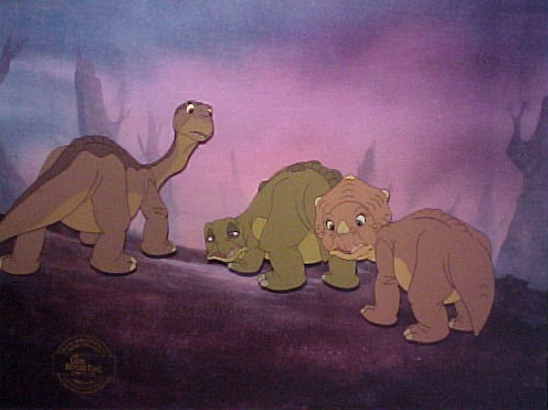
Throughout the course of the movie, about every scene is related to something we learned in class. From the beginning to the end land forms such as Volcanoes Continental drifts and earth quakes take place. In the picture above behind the two characters you can see a screenshot from the movie. In the background you can see the after math of a right strike fault. In the movie after days of travel the earth starts to crack due to plate tectonics grinding.
http://images3.wikia.nocookie.net/__cb20080902003136/landbeforetime/images/0/04/COMV.jpg
The picture above shows a rock wall which looks a little bit deformed. This was most likely created by the process of folding. This is caused by the compression of two plates moving toward each other, which cause the rock to fold on top of itself, giving it the look of going one direction and then the complete opposite direction. This type of fold would be classified as a syncline.
The video clip above shows two tectonic plates pulling away from each other causing an earthquake. This type of plate interaction is divergence. Eventually towards the end of the earthquake lava can be seen shooting from between the space between the moving plates. This is also accurate with the process of divergence because it usually involves lava coming between the newly created openings to create new land.
The little ledge that she keeps running into could have been from a fault through extension. The ground pulled apart and most likely descended in level, causing the little drop off. You can tell the land pulled apart to make the drop off because of what is sharing the two different elevations of land. There is a tree in the middle of two different levels of land and you can tell the tree originally grew on the top piece of land because all of the roots are exposed on the bottom half. The area that she keeps running into would be classified as a scarp which is often times created when extensions happen at faults.
March 11, 2013
 |
| http://www.rickbentham.com/animation/land_before_time/The_Land_Before_Time_Background_1.jpg |
The picture above demonstrates rock decay in the form of weathering. This is the breaking down of rock which can be due to altitude, climate or location. At one point in time these rocks were in one large strong peace but over time because of the joints and cracks in the rock, physical weathering has entered and caused the rock to decay. These cracks can be caused from thermal expansion, frost weathering or pressure release. In this picture because the weather looks like it can be either hot or cold the cracks in the rock most likely formed from frost weathering. Upon freezing the rock increases its volume. The water inside freezes causing the ice and the rock to expand resulting in high pressures and fracturing the outside of the rock. The rocks that are falling represent mass wasting resulting in factors such as the rock structure and the gravity. The unstable down slope in the rocks are causing them to fall down the side of the cliff. After detachment the small rocks fall producing talus. The talus that is built up at the bottom of the rock is demonstrated in the water below the T-Rex.
 |
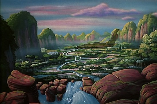
http://www.geekosystem.com/wp-content/uploads/2010/05/the-great-valley-550x366.jpg
|
The image above includes a surface water runoff, this is where water flows over the surface and the ground doesn't have the ability to absorb all the excess water. As a result of zone aeration, water and air below the surface push water up through the pores of the land. Ground water will always return to the surface because of the base flow of the stream. The picture above leads to marshes and rivers draining the water from one end to another, these are key characteristics of drainage basins. Drainage basins come in all different shapes, sizes, and densities. What is not seen in the picture, but could be created downstream are drainage basin characteristics such as transportation and deposition. Transportation is a large amount of water, typically in the middle of the basin. Deposition on the other hand occurs at the lower end of the basin which is described as a large river breaking off into multiple streams. Although not shown in the picture this is what is usually predicted to happen in the scenario of a down sloped runoff. At the bottom of the picture, the streamflow that is seen is an Overland flow, this was probably caused by precipitation exceeding the infiltration capacity.